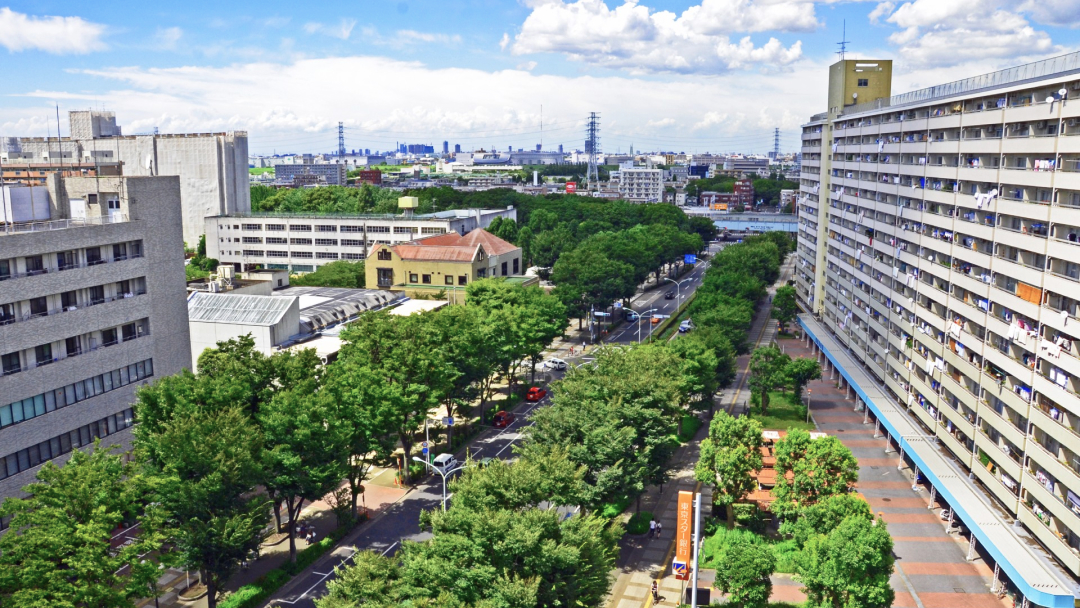
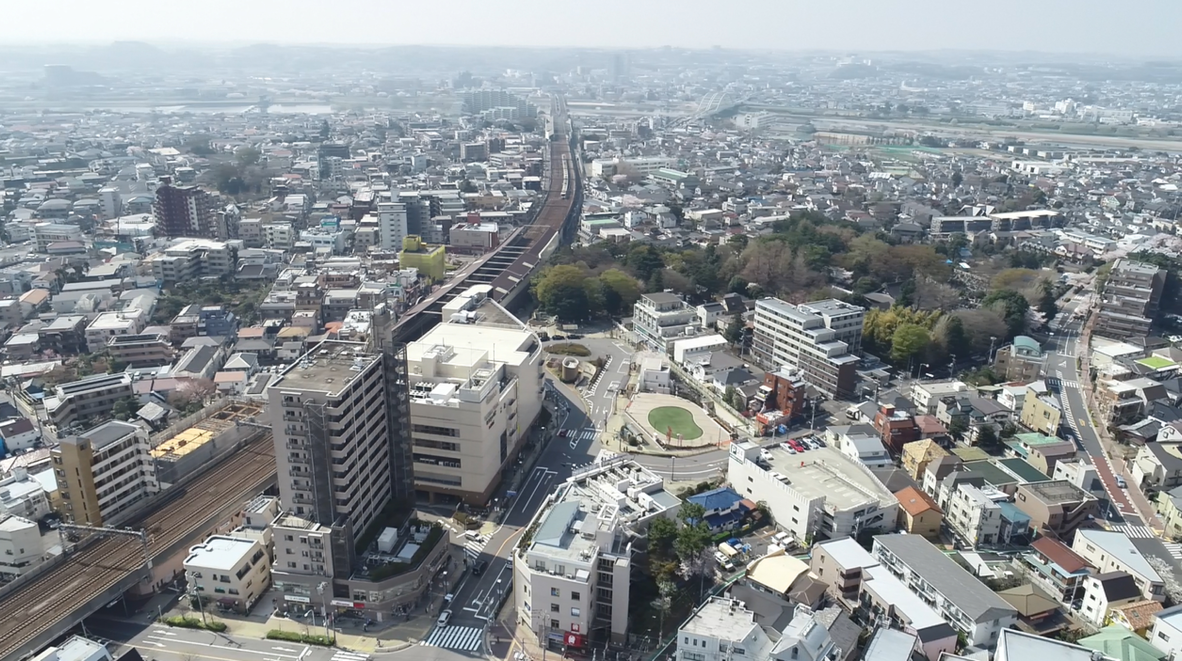
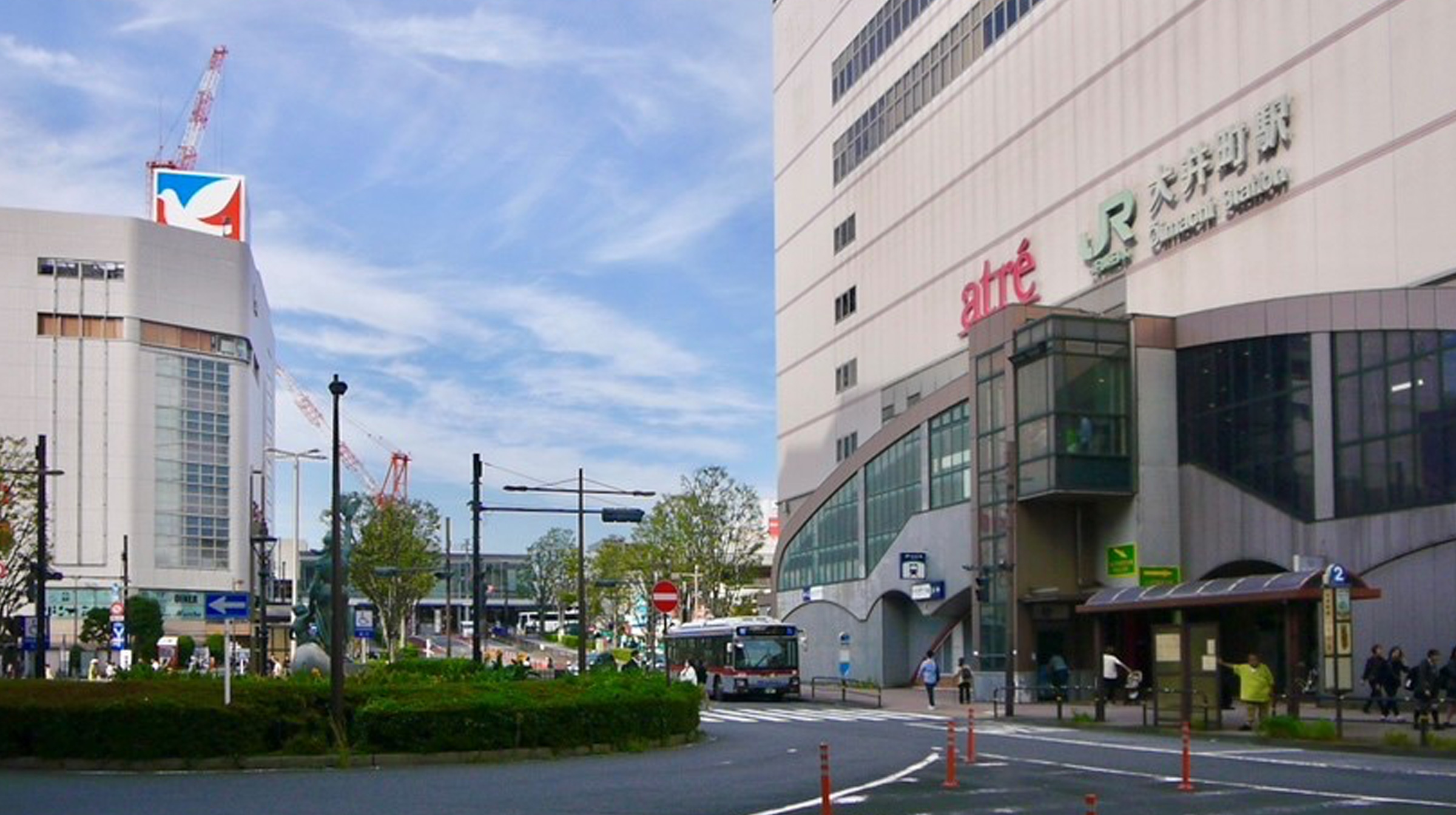
OIMACHI – SHINAGAWA CITY


1.Project Overview & Objectives
Learn urban development from Japan and overseas
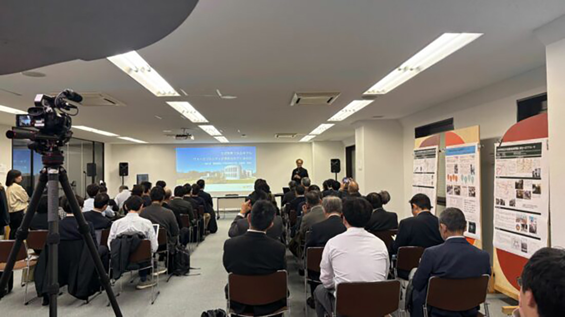
We will hold classes on urban development to provide opportunities for the administration, residents, and business operators to learn information, knowledge, and innovative initiatives from Japan and overseas regarding the ease and enjoyment of walking around as well as the issues and approaches to urban development that make people want to walk around.
Exploring the walkability of the city
We will hold street walking workshops to discover the ease and enjoyment of walking, as well as the challenges and possibilities of the target areas. In addition, with the participation of residents, we will use GIS tools to collect and share information on those topics so that it can be used immediately in urban development workshops.
Show the rhythm of the city with analysis of big data
We will integrate multi-source geospatial information such as city planning data, social media text data, people flow data, and street walking data into a two-dimensional/three-dimensional data platform to visualize spatiotemporal movements of residents and visitors in the target areas and provide content to the Tokyo Data Platform.
Create an action project
We will examine a project to shape the urban development policy and GIS tools to support it, develop prototypes based on the knowledge obtained from the urban development lectures and street walking workshops and the 2D/3D digital information obtained, and conduct social demonstration experiments.
2.Past Efforts
Share vision of urban development
We comprehensively organized the Shinagawa City Master Plan, Oimachi Urban Development Policy, residents' awareness survey conducted by the Urban Development Oimachi non-profit organization, and results of research conducted by the Keio Research Institute at SFC. In addition, Shinagawa City has been considering a project to create space for pedestrians on Oimachi Ekimae Chuodori. As a result of the comprehensive review of the information, knowledge, and efforts, we decided to propose "Walkable City" as the vision for Oimachi's urban development.
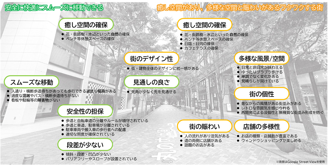
Creating walkability indicators
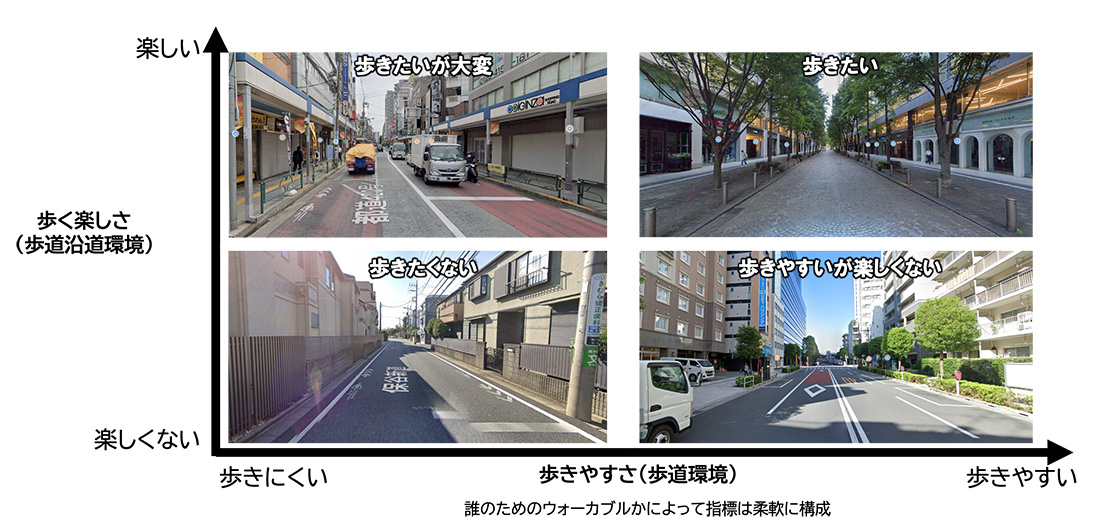
We systematically organized the walkability index reported in projects by the Ministry of Land, Infrastructure, Transport and Tourism and academic research. After examining a large number of evaluation items, we selected survey items using the two axes of "ease of walking" and "enjoyment of walking," as these are easy to understand and easy to use, decided on the method for conducting evaluations, and verified their practicality in the field survey.
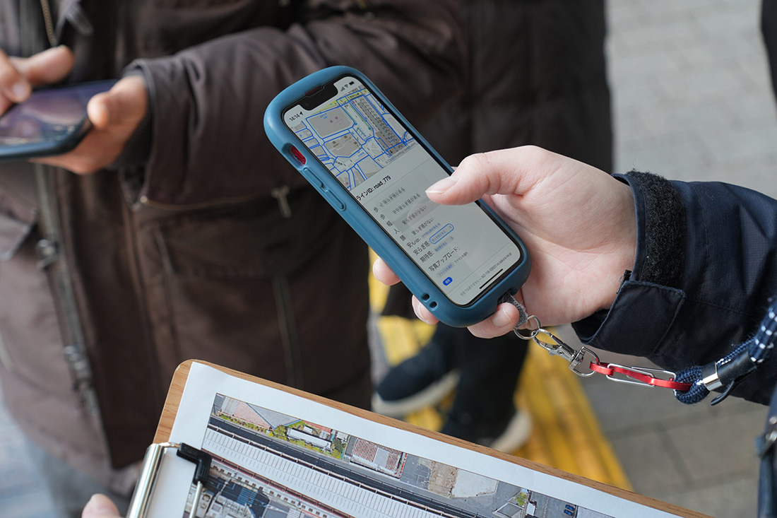
Development of tools to support street walking
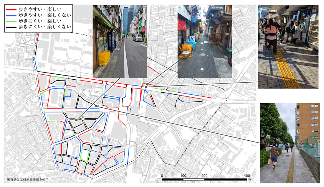
We created our own detailed street walking map based on high-precision satellite images. Based on that map, we developed a GIS tool that makes use of smartphones and the cloud to conduct walkability surveys for each pedestrian walkway. The tool was put into use in a field survey and the information was shared in real time at urban development workshops. We were also able to confirm the effects.
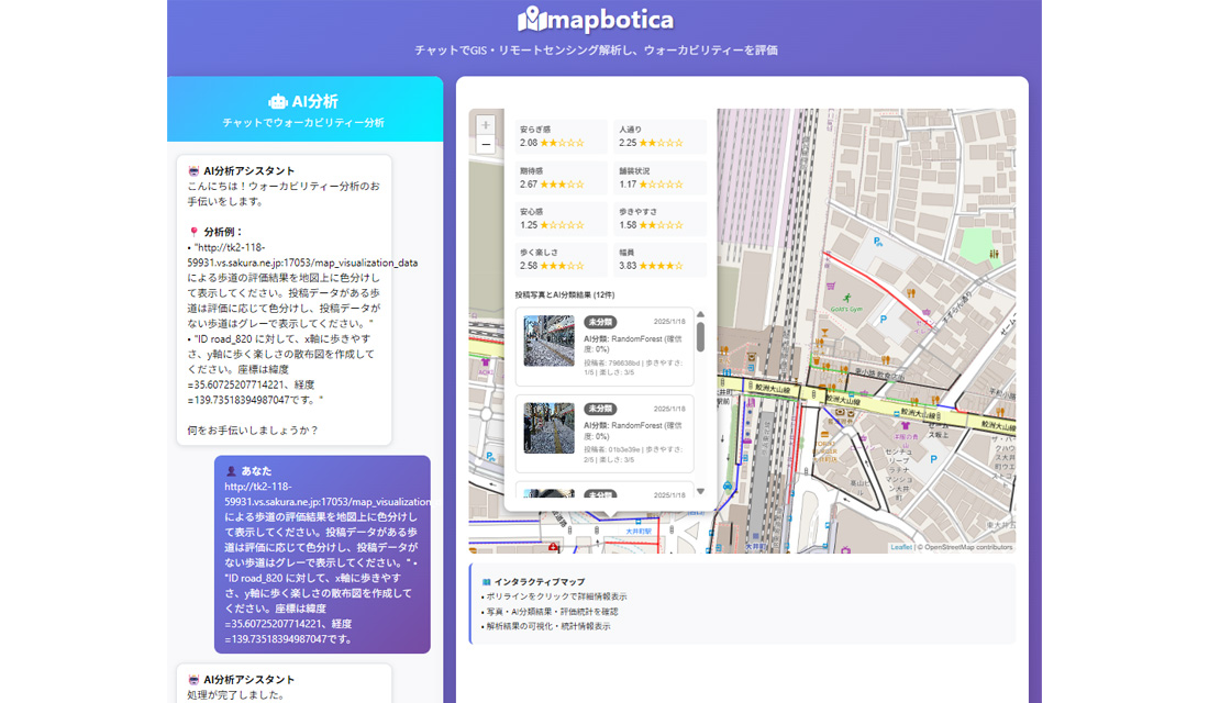
Development of 3D data platform (UMEX-4D)
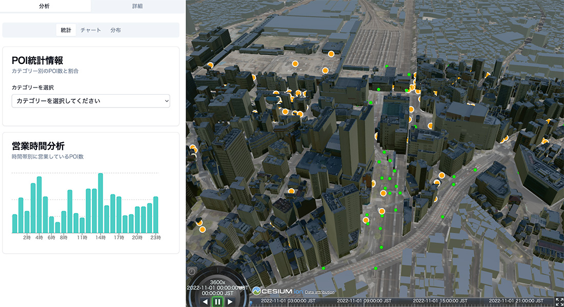
We selected fundamental technology for visualizing and analyzing the walkability-related data and developed a platform, UMEX-4D, that could now analyze data that was previously analyzed on a flat surface with the added dimensions of "height" and "time." We implemented dynamic analysis of data by integrating movements of the persons (GPS) and destinations in the city (POI) on top of a 3D city model (PLATEAU).
3.Upcoming Schedule
Hold urban development lectures and consider urban development policy:
In cooperation with local entities and organizations, we will propose a vision for urban development that encourages people to walk around. We will give shape to the content and policy through lectures and street walking workshops. In addition, we will expand the networks with residents and business and develop concrete measures to achieve this.
Select methods to survey whether a city makes you want to walk around and decide on the evaluation methods
Using established survey methods, we will consider increasing the amount of survey data as well as evaluation items for the development of sidewalk networks and ease/enjoyment of walking around. At the same time, we will present the survey results at workshops and lectures and use them to formulate policies for the development and implementation of walkable cities.
Improvement and practical use of GIS tools that support street walking
In addition to improving the usability and operational stability of GIS tools under development, we will consider ways to develop them into versatile walkability survey tools by improving user interfaces, utilizing image information, and enhancing aggregation and analysis functions.
Implementation of 3DGIS data platform (UMEX-4D) and consideration of use cases
We will deepen UMEX-4D and implement it in society. We will develop a 3DGIS Data Platform (UMEX-4D) with 3 features.
- Addition of data: Integrate diverse walkability data into the platform.
- Addition of AI capabilities: Support interpretation of complex information according to user needs.
- Utilization of workshops: Develop specific use cases and conduct workshops using the UMEX-4D.